Activities You Cannot Miss Out On In The El Chorro Natural Park
Who said that holidays are for resting? The best thing about travelling is being able to enjoy the natural environment and do sports while seeing different places, and what better way to enjoy all this than on Greenway GR 141 or Gran Senda de la Serranía de Ronda, a beautiful circular trekking route that is split into six stages and passes through the valleys of the Rivers Guadiaro and Genal, which in the olden days were transited by those who travelled between Serranía and Gibraltar.
The best way to get to know a place is to leave the roads and get into the countryside, and on the Serranía de Ronda via verde, this is the only way, since today’s motorways were not built along the outline of the old paths that connected villages, so there is a whole hidden world that you will be able to discover on this beautiful Ronda via verde.
Put your boots on, follow the path and walk many miles, but don’t worry about being along, since this route passes through most of the localities of the villages of Serranía, so you can fuel upon food and drink. Don’t think twice about it, Gran Senda de la Serranía de Ronda is expecting you.
Hiker’s 10 commandments
Before we explain the route we are going to follow at each stage, it is important for us to know the rules that all good hikers must adhere to to keep this wonderful setting in a perfect state of preservation, since we need to remember that we are just visiting and there is a multitude of species, both plant and animal, that do reside in these landscapes, so we should protect them.
GR141- Ronda
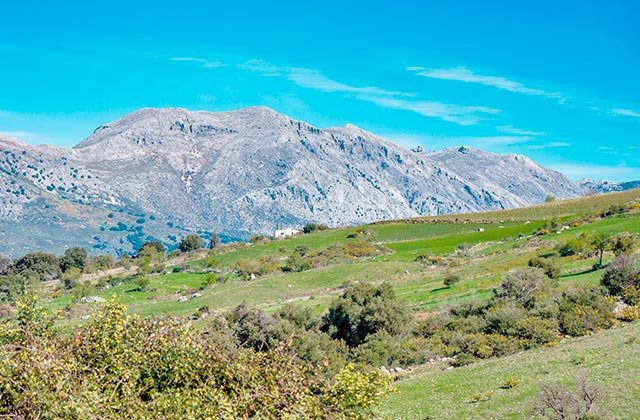
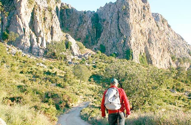
As we said, this trail is a circular path that is very popular and links existing paths between the different villages of Serranía de Ronda. It is made up of six stages. Don’t let this scare you, since even though it is a tough route due to its ascending and descending sections, if you take your time, you will have nothing to worry about.
Wikiloc – GR 141 Gran Senda de La Serranía de Ronda
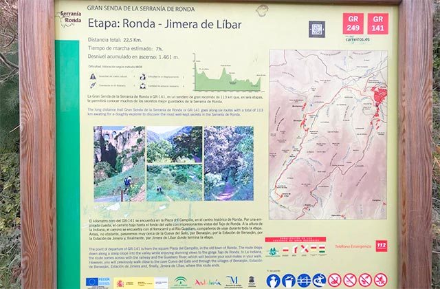
Ronda – Jimera de Libar – Crédito wikilok.com
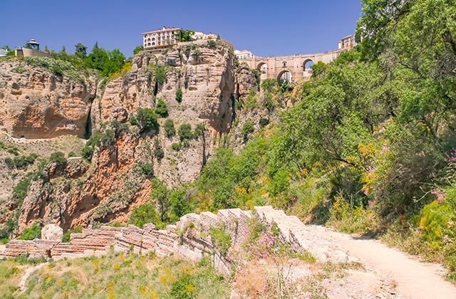
The start is located at one of the historical entrances to Ronda, from where it is possible to make out the majestic Tajo and Puente Nuevo. We start our route at plaza María Auxiliadora de Ronda. A cobbled path will take us to paraje de los Molinos. Once there, a path will take us across the entire skirt of Tajo to arrive at Puerto de la Muela. From this point, we follow the path until we deviate along a path that will take us close to Benaoján motorway. After crossing it, we arrive at paraje de la Indiana. After passing through a level crossing with no barriers, we will turn left and take the path that takes us close to “La Pasada de Gibraltar.” Now a path will be taken that runs parallel to the railway line and takes us further away from it as it ascends towards Puerto de Ronda and from here we will descend along a dirt track to Benaoján.
We cross the locality up to the train station and again cross a level crossing to immediately cross the River Guadiaro. This path takes us to Jimera de Líbar station. We advise you to always walk parallel to the river and this will take us to the municipality of Jimera de Líbar and the end of the stage.
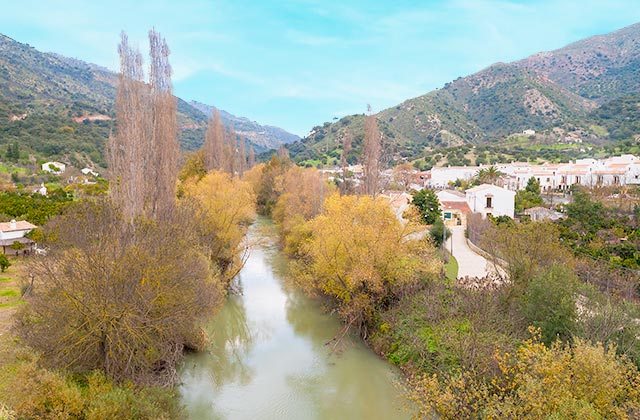
Jimera de Líbar
El Guadiaro marks the stage that transits between Jimera de Líbar and El Colmenar or Estación de Gaucín. We start the route by taking the road that goes in the direction of Atajate. Around 100 m to the right, a paved path appears that takes us to a crossroads on the left and that we will take and will take us downhill until it passes through an animal grid. Now we are here, we need to keep an eye out for an important crossroads with a sign that reads “PATH,” but we must not take it, but rather keep straight ahead along this path until we reach the recreational area of dehesa de Jimera de Líbar.
We continue until we reach the Judio stream, which we will wade through in order to keep going up to a clearing full of walnut trees. We will walk along the edge next to an irrigation pool. Once we have passed the pool, we will see a path that takes us to a stream that we will also cross until we see a path that takes us to another stream to quickly arrive at Honda Laguna. From the lagoon, we take a dirt track on the left that takes us to cortijada de Siete Puertas. From there, we continue along the path which we will stay on until we reach a farmhouse next to Garganta de las Buitreras. From the farmhouse, a pathway takes us to Puente de los Alemanes, which we will cross to reach the end of the gorge.
We will continue on the path up to Charco del Moro and continue along the pathway, and will arrive at a hanging bridge. Once at the other side, a service truck will take us to El Colmenar.
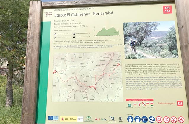
Colmenar – Benarrabá – Crédito wikilok.com
We will start this stage next to the crossroads that leads to Las Buitreras station. Right at the other side of the bridge, a small descent takes us to a path. Once there, a real climb awaits. Once the first ascent has been completed, a path takes us to an old track that leads us to cortijo del Peso. Here we will see a crossroads that we will take until we reach the forest house that we leave on the right. We will then take a path up to Puerto del Hacho, where we will arrive at Gaucín.
Once we have passed Gaucín and when we arrive at the viewpoint bearing its name, we cross the road to arrive at “Salto de Cura.”. A path will leave us next to a trail that after a few miles will turn into a fire barrier. Once here, we will follow and stay on the pathway up to the end of the stage.
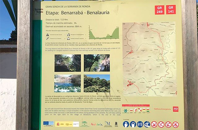
Benarrabá – Benalauría – Crédito wikilok.com
We start the new stage next to Sierra del Espino Public School. A pathway opposite is our route. A path will leave us on a dirt track to “La Escribana.” Here we will walk along the left edge of the river until we ascend to Genalguacil. We need to follow some paths that will leave us in front of the bridges that cross the Genal. After crossing the three existing bridges, we will see a dirt track that soon becomes a path again that will take us to Venta de San Juan. From here, we will head towards Algatocín until we enter the national forest trail to then cross Benajamuz stream and arrive at lomas del Capitán. Next to a small one, we will see an ascending path, which is our trail that will take us to molino de Piña, and we keep going until Benalauría.
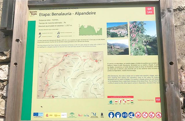
Benalauría – Alpandeire – Crédito wikilok.com
We start our tour from the village centre, go up calle Fuente to leave the locality by the road connecting Ronda with Algeciras. After crossing it, we take a path on the right and without leaving the ravine and almost at half slope, we can see Benadalid, so we keep going until we reach the village. When in the locality, we will take a paved path that will lead to an old trail that will take us to the old venta de San Isidoro. Once we cross the road, we will head to Ronda until we see a dirt track that will go under the road and leave us near Atajate. Once in the village, we will head towards Alpandeire, a path that opens out onto a track that we will leave to take a pathway, called the el camino de la Audalázar and this will take us to Alpandeire.
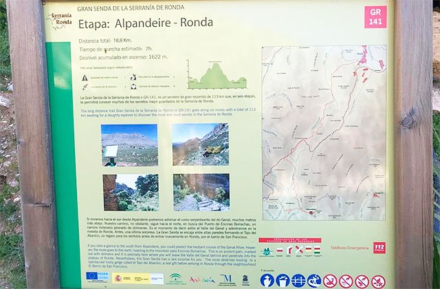
Alpandeire – Ronda – Crédito wikilok.com
We will start this stage by crossing de la Fuente steam to pick up the track that arrives at a crossroads where we will go to the right until we reach fuente del espino pathway until we cross Audalázar stream and reach the road and “el camino de la amargura”. We leave the road to continue towards dolmen del Chopo, and will continue along here until we arrive near to dolmen de Encinas Borrachas, where the trail splits, and will go to the right until we enter Tajo de Abanico. We pass the stream and ascend along a path that opens out into a path that we should stay on until we reach the entrance to Ronda. This is our final destination and the end of the stage.
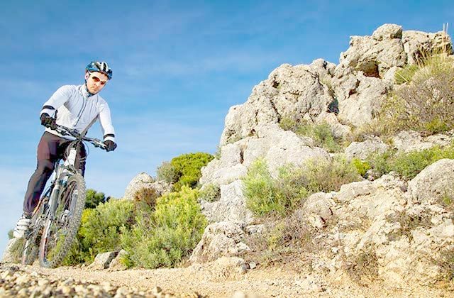
GR 141 – bicycle
All the stages of the Gran Senda de la Serranía can be done by bicycle, so if you’re into pedalling, this route will put you to the test. There are also a bunch of activities and interesting places along the way (vias ferrata, canoeing, rafting or climbing) that will delight adrenalin addicts.
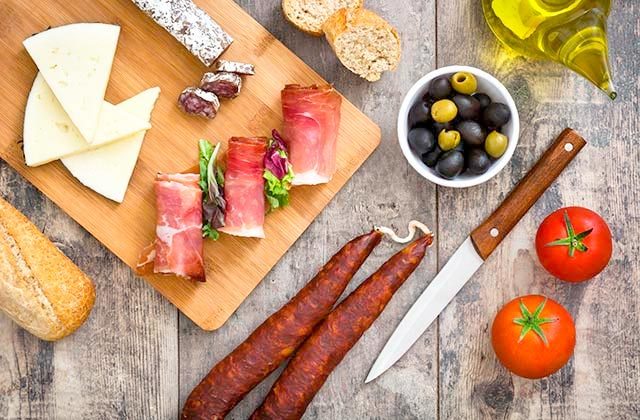
GR141- Local gastronomy
The greatest pleasure of active tourism is stopping to fuel up without a guilty conscience and the gastronomy of Serranía de Ronda is, without a doubt, one of the best on the Iberian Peninsula. Who can say no to snacking on some olives, potatoes, cheese, cured pork or Iberian ham?
Are you still thinking about it? If you opt for this pretty route, we can guarantee that as soon as you complete it, you will be enormously satisfied with this impressive adventure that connects mind, body and emotions while you enjoy unparalleled landscapes.
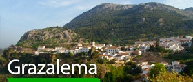
Put on your boots and explore the 20 best Grazalema hiking trails
Discover the beauty of Bosque de Cobre in Malaga through its villages and its hiking trails
The best hiking trails in Alpujarra Granadina
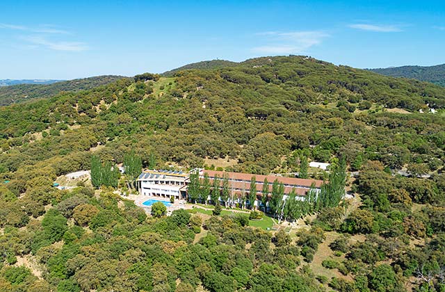
Hotel Fuerte Grazalema
If you end up deciding that you can’t let this adventure pass you by, the perfect place to stay is hotel Fuerte Grazalema, where you can rest body and mind at its swimming pool and jacuzzi after an exhausting couple of hours walking this route. This hotel, one of the most recommended in the area for its quality, tradition and service, has become a place that must be experienced at some point. It also has a small farm, spacious rooms, a restaurant with a unique panoramic view and cuisine based on local produce, and also allow pets. And if you think that the route we have offered you is not doable, but you still want to visit this dreamy natural space, here are some other routes you may be able to enjoy.