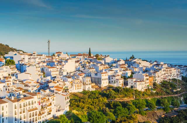
Activities You Cannot Miss Out On In The El Chorro Natural Park
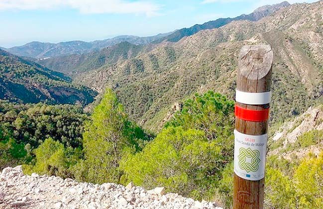
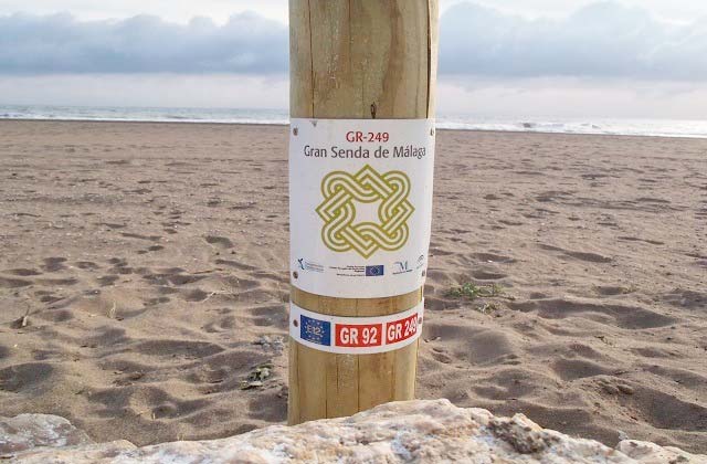
White and clustered villages, vineyards and paseros, strands of olive groves, impenetrable massifs and closed forests, calm lagoons and trickles of spirited water,… the Gran Senda de Málaga is the best on foot proposal to discover all and each one of the spectacular corners of the province: inland and coast, sport, culture and nature.
Over its more than 650 km and 35 routes, the Gran Senda de Málaga covers 9 counties and 50 municipalities, penetrates or circles 13 protected natural spaces and allows you to reach the heart of its people. On foot, by bicycle or on horseback, through hiking trails in Malaga, paths and roads, river basins and lakes, steppe areas, mountain and coastal areas, you will be able to meet and enjoy the essence of the province of Malaga.
It is your Gran Senda (Great Path) and today we show its beginning, don’t miss it!
The first trail of the Gran Senda routes Malaga heads eastward following the coast line, to the region of Axarquía. It is an accessible trail for its length but, above all, for the few slopes it has.
To connect the Western area of Malaga and Cala del Moral, in Rincón de la Victoria, we have to take a gentle arc to the North and following the profiles of the Malaga Cove and, of course, cross the old town mainly by boardwalks. Gradually, we are passing by the different coastal districts in Malaga from the ones located in the center until El Palo, traditional place of beach bars and restaurants with the known espeteros.
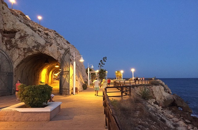
The Road of Almeria sets the end of this coastal landscape model when Puerto del Candado appears, some marine cliffs (that that road preserves through a tunnel) and the shocking Cement plant of Araña. The end retrieves the beautiful sandy coves with the ones of Peñón del Cuervo, while the maximum height is located further on in Torre Vigía de las Palomas, at 23 meters above sea level.
The tour continues alongside the Nacional 340, by the right shoulder, and ends next to the limestone cuts of Cala del Moral in the bridge that allows to cross without problems the Arroyo Totalán, that is the border of the municipalities of Malaga and Rincón de la Victoria.
The GR-249 offers to begin with the opportunity to visit almost all of the capital’s coastline. After a long history of oblivion, 19th century Malaga has begun the Millennium opening towards the Mediterranean Sea, that always was what gave it sense as city.
Numerous developments testify to this new approach in the Port area, specifically through actions that, of course, have generated long discussions and that the trail runs through one by one. In the meantime, the Guadalmedina River still waits for its turn, claiming the environmental role and citizen use as the other great backbone of the city.
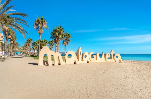
The territorial pattern of this part of the Western coast of Malaga has many years of settings, so it retains part of the fishing idiosyncrasy that is its raison d’être while adapting to the new times. The traveler will contemplate emblematic places like the Port and its Streetlight, the Beaches of Malagueta, Caleta, Pedregalejo and El Palo and the numerous bars that at the beginning of this century are also looking for its own place and aesthetic.
The last part of the journey encloses a series of different surprises, from privileged nature spots with exclusive botanical species until perfectly preserved medieval beacon towers, through manufacturing plants next to the beach or secluded coves of evocative landscape. A compendium in no more than 15 kilometers, in short, the evolution of the Costa del Sol, until you reach Rincón de la Victoria.
This long tour begins in the municipality of Rincón de la Victoria, whose beaches you can fully know from Arroyo Totalán in Cala del Moral to the Tower of Benagalbón. Then goes by the coast of Velez-Malaga but leaves the coast progressively to wander by the hills of shale and slate and then by the fertile orchards of the Vélez River Plain. Almost at all times coincides with the East-West path of the Nacional 340, touching in several occasions the Gran Senda de Málaga, until the trail pulls towards the North in the Vélez River.
Uses the GR-249 to progress the enabled boardwalks but also dirt roads, pieces of beach, footpaths and road verges. Most of the route is quite accessible, but the length, the detours at the end and the arrival in the industrial area can give it a tougher image than it actually has. On the other hand, the heterogeneity of the route plays, in this sense, in favor of the beauty of the trail, with its constant scenery change, connecting the beaches, the landscape.
A good way, in any case, of knowing the coast of a Hiking Malaga region as peculiar as Axarquía and its main river.
The eastern coast of Malaga appears before the eyes of the traveler in Rincón de la Victoria as an urbanized continuity where the beaches have been restricted sometimes up to the limit, but according to the enormous remains of prehistoric and historical occupation it seems that this coast line never escaped from human presence. This is the first incentive of the route, check how the coast resource has been faced up, of whose very different productive models there are excellent examples.
History with capital letters overlooks the Gran Senda de Málaga through caves of archaeological interest, Phoenician towns, Roman villas and factories, Arab farmhouses, medieval watchtowers, eighteenth-century fortresses and quarries and ancient roads.
Nature survives timidly in the sea cliffs and within the limits of the wider beaches, with beautiful towns of Samphire or Cakile maritima. And, as remnant of the agrarian and rural coast that still persists, it’s worth venturing into what remains of traditional irrigated crops in the flood plains of the river Vélez, before reaching Vélez-Málaga, where the extemporaneous picture of a pajunos’ yoke of oxen plowing the same ground that sustained in the past centuries old sugar mills, refineries and sugarcane wheel grinders may surprise the user.
Velez Malaga and Torrox are in river valleys separated by three others that run South from steep hills. The communication between both could not be direct in order to not extend too much the way entering and leaving the valleys. The route layout was trying to soften the problem descending close to the coast and ascending back up. This same solution is taken on GR-249 to solve the third route. First down South to Puerto de la Caleta, by Camino Viejo de Algarrobo and Seco River, then heads towards East/Southeast for 10 km following the coastline to Punta de Torrox and finally ascends to the destination village crossing another River, pulling North.
The slopes are not too important and are concentrated especially in the beginning, with a slight slope to reach the hamlet of Torrox, the length is quite accessible, that invites you to enjoy the trail. There are a couple of sections that use the dry riverbed of the watercourse, some dirt tracks, a path and the rest is promenade.
Here are joined the ancient and the 21st century Malaga. The first (Vélez-Málaga) is represented by beacon towers and Roman and Phoenician sites. The second (Torrox) is focused on two types of different industries but both debtor of the excellent climate of Axarquía.
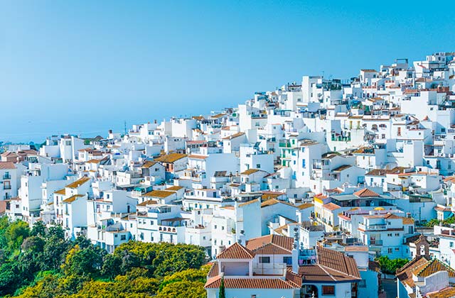
Tourism, on the one hand, is concentrated in the coastal strip, and surprisingly you will get to know already extinguished urban models in most of Costa del Sol, corresponding to the second half of the 20th century, living together with newly built housing areas under very conflicting parameters. There are fishing areas that maintain their roots, lines of houses whose horizon is the sea and its products that evoke own and strange past times. This is one of the most attractive for the visitor.
The other industry generated by the kindness of the climate parameters is the agriculture based in arboreal subtropical crops. These are located mostly in the valleys, taking advantage of its shelter but also of a vital resource: water. We will see advanced technology holdings that have just settled in the slopes of Axarquía, but in others places also the centennial terraces and albarradas that have adapted to the new times welcoming these others species and new markets.
In any case, and with this amalgam of possible components, route 3 offers a variety of worthwhile landscapes, among the rural and the urban and with several productive sectors involved, but all this deeply embedded in a very peculiar physical environment that this tour invites you to know.
The fourth route is responsible for descending from the municipality of Torrox to the Nerja coast and, after three routes with the reference of the N-340, in this case the chosen path is twinned with the one used by the Autovía del Mediterráneo. With a perfect general direction from West to East, the traditional road that is used is the Cañada Real from Motril to Malaga, that the Gran Senda Malaga follows scrupulously except in the cases in which the highway has settled on the same, disabling it.
The first obstacle to overcome is the backdrop of the important Torrox River, that was solved, since immemorial times, by a bridge of two arches and a ford, in the fork formed by the River’s main course with a small tributary that comes from the East. The path then ascends to the hillock located between Cerro Pastora and the one of Puerto, 265 meters above sea level, from there we take the southern skirt of Cerro Pastora without losing height using dirt tracks. The descent to meet again with the A-7 begins in the first housing estates and asphalt, the GR finds a second ford (Seco River) in the long journey through the service roads adjacent to this road traffic infrastructure, until it crosses it underneath, passes through suburban neighborhoods on horseback between Frigiliana and Nerja and wading the Chíllar River.
The length, the slopes and the type of road used, especially rails, makes the route quite accessible for the traveler where there are only a pair of strong slopes to overcome, one going up and another coming down.
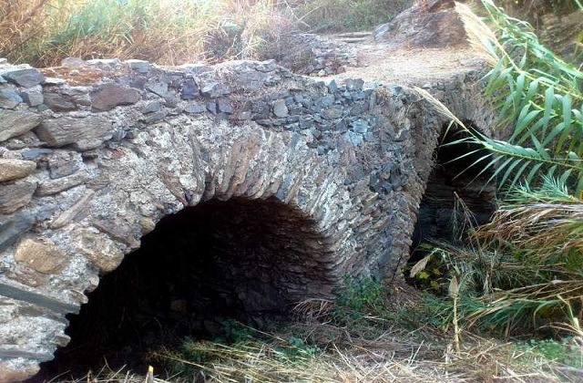
Puente de las Ánimas is a good example of traditional road infrastructure that has been able to read the terrain to find the best location taking into account the destination point. Built with local materials, it is necessary to outline its importance for the people, despite the fact that its former shine pales beside the imposing viaduct that stands a few meters away.
The hills of schist surrounding Torrox to the East seem to want to claim its status of mountain in this area, both by heights as by the slopes it generates. To this contributes the Torrox River, that marks a deep scar in this rugged geography. Subsistence farming, extensive cattle-breeding and the mountain uses have deforested the landscape over the centuries, although occasionally some isolated testimony of the original oak and cork tree that rose here arises. There is a shady area where this is especially clear, among the km 1.5 and 3. The biodiversity of shrubs is important and the associated fauna, especially birds, quite relevant.
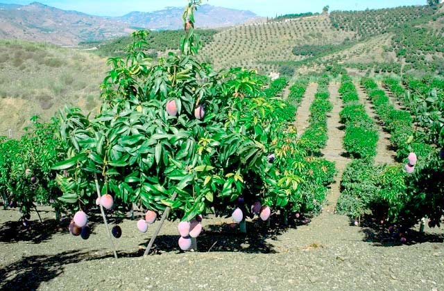
For the first time, on the other hand, the GR-249 allows you to visit during a long stretch different types of subtropical tree crops, from the vast areas of irrigated land of the southern slope of Cerro Pastora to the small terraced farms where the omnipresent avocados of different varieties are mixed with Kiwi fruit, chirimoyas, mangoes, papayas and loquat. This is a new industry that keeps gaining ground as it has enough water in relation to the old rain-fed crops that are still located above these newly arrived: long albarradas with rows of olive trees, some almond and the remembrance of vines.
All the coast of Axarquía has seen its landscape be modified at the beginning of the Millennium by the lush greenery of these foreign trees, that require temperatures that are hallmark of Axarquia and have water requirements that demand an intelligent management of the resource.
Finally, the passage by the end sections of the Torrox and Chíllar rivers heading to Nerja station the realization of future routes of the Gran Senda Malaga in which we will know each one of the tributaries watersheds of these significant rivers that head directly to the Mediterranean, towards the South. The Sierras Tejeda and Almijara, that seem to be far, provide the so necessary water for the consumption and the industries, especially agricultural, through these drains that have deep roots in the wooded highland surfaces.
We leave close to the sea and in a long rise we gain an important altitude, 565 meters above sea level. Although there are sections of forest track, the paths prevail, with two good descents seeking the Chíllar and Higuerón rivers and as many ascends always on dolomitic ground occupied by Aleppo-pine forests. Pay attention to the accumulated slopes.
From a tourist and coastal municipality such as Nerja, and taking as reference or anticipation of change the cave of Nerja itself, we move to a wild and untamed mountain.
This route allows us to know two of the most important rivers of the low Almijara in its eastern sector and the Barranco de la Coladilla, usually dry. Through the Sierra de Enmedio with spectacular views of the most singular Gorges in this part of the Sierra, like Almendrón or Sol, and peaks like the Navachica or Cielo.
The Higuerón and, above all, the Chíllar riverbeds are highly frequented by fans of water trails, and we highlight the channel and water intake network for hydraulic and horticultural use in both rivers. The trail ends between higher limestone cuts where shelters and caves appear until the Cuesta Apero, steep and in concrete that ends in the same Plaza del Ingenio in Frigiliana.
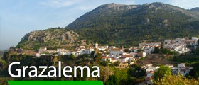
Gran Senda de la Serranía de Ronda (GR 141): a walking challenge to enjoy the best natural setting
5 hiking trails to discover the province of Malaga
Olée Nerja Holiday Rentals
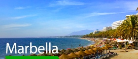
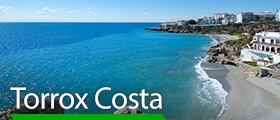
The best option to stay is Fuerte Hoteles. The chain has facilities where you can enjoy, in addition to its services, the best of each point of the Andalusian coast. Its more than 60 years of experience are the best guarantee to dedicate your time only to relax and enjoy the Sun and the sea. Marbella or Torrox are some of the spots where you can find these amazing accommodations close to the beach where you can enjoy the best views.