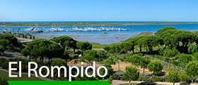
Activities You Cannot Miss Out On In The El Chorro Natural Park
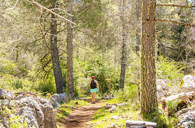
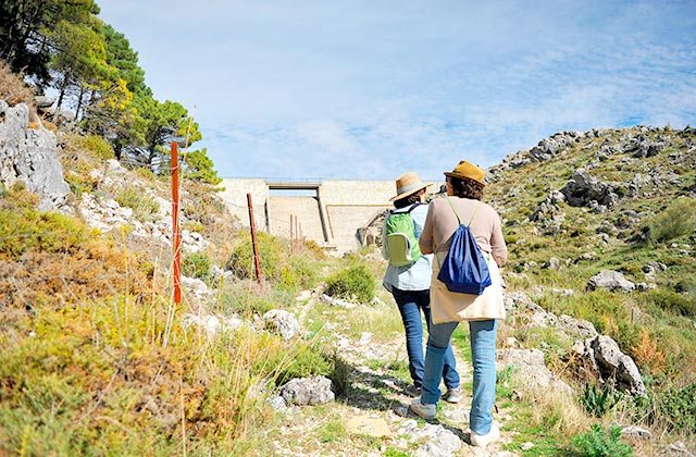
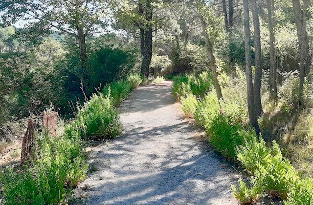
The Grazalema hiking trails are a great attraction for lovers of active and rural tourism. They also prove to be rather seductive for lovers of natural environments of ecological interest. They are paths that run through the Sierra de Grazalema Natural Park, declared a Unesco Biosphere Reserve.
Hiking in Grazalema will allow you to get to know and look at beautiful enclaves. You will visit places inhabited by unique plant and animal species. There are so many attractions offered by hiking trails in Grazalema that they are some of the favourites of those who hike in Andalusia.
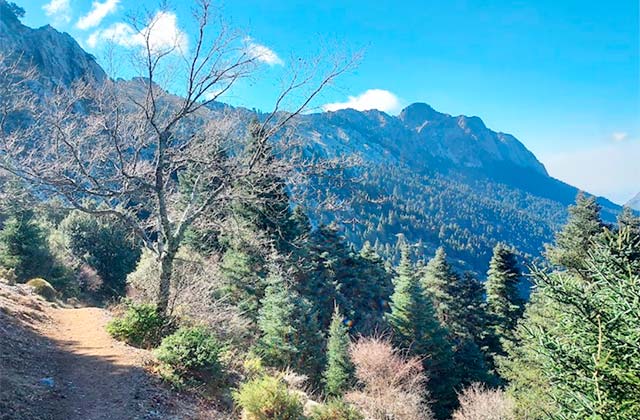
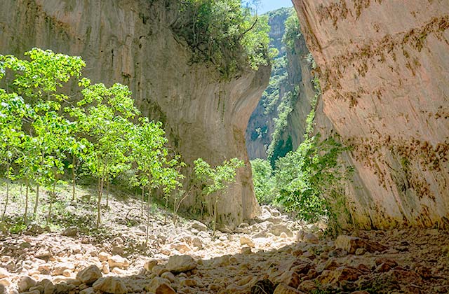
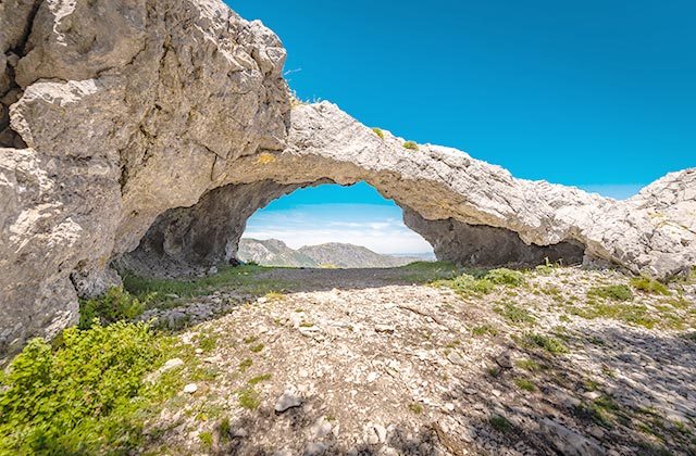
The Del Pinar Sierra with its fir trees and the Del Torreón Mountain or Peak, the highest in Cádiz province. The characteristic karstic landscape, result of the water and limestone rocks. This is the rainiest place on the Iberian Peninsula. The Verde Gorge, inhabited by the griffon vulture along with the goshawk, booted eagle, otter, mountain coat, deer, roe deer and others. These are just some of the wonders to be found on hiking trails in Grazalema.
Hiking through the Grazalema Sierra will also allow you to get to know the customs and traditions of villages such as Zahara de la Sierra, Prado del Rey, El Bosque, Benaoján, Jimera de Líbar and Grazalema. You can also enjoy the area’s delicious and varied gastronomy.
Here are 20 hiking trails that are essential if you want to get to know the Sierra de Grazalema Natural Park. Their names, the places they traverse, the distance they cover, the time it will take you to complete them and each one’s degree of difficulty. The landscape will be different depending on the season, but either way, always beautiful and full of life.
From Grazalema, take the A-372 towards Benamahoma. After 1.50 km, turn right towards Zahara de la Sierra. The route starts 1 km away, on the left-hand side of the road.
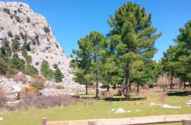
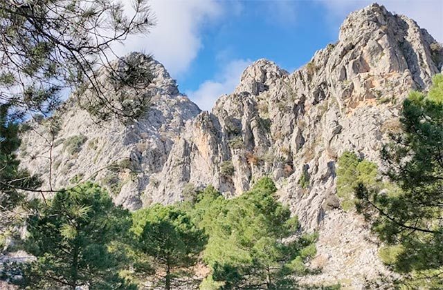
This trail runs along the northern side of Sierra del Pinar amongst Spanish Firs, a unique kind of Fir tree that led to the area being designated a Biosphere Reserve and Nature Park. This trail starts with an uphill hike amongst reforested pine trees that have helped to mitigate the erosion caused by intense rainfall. Further up, hikers reach Puerto de las Cumbres, which o_ers wonderful views of Serranía de Ronda and the highest peak in the province of Cadiz: El Torreón at 1,654 m.
We gradually emerge ourselves in the forest of Spanish Fir trees, with the canopy permitting very little light to penetrate through to ground level.
Spanish _rs are one of the new species of _r trees that reside on the mountains bordering the Mediterranean. In Andalusia, they can only be found in Serranía de Ronda and Sierra de Grazalema, covering more than 400 hectares.
Generally, they are located on the northern slopes of mountains, protected from excessive sunlight, and the consequent loss of humidity, allowing the forests to grow in density and shade.
Sierra del Pinar serves as a barrier against the clouds that drift in from the Strait of Gibraltar, meaning that this mountain range records the highest rainfall on the Iberian peninsula.
At the end of the forest, the Spanish firs give way to gall oaks as we head downhill, keeping our eyes peeled for a sight of the small town of Benamahoma, where hikers can catch the bus back to Grazalema. (Check departure times, as the bus only leaves once each day).
Note: Before setting you must obtain a park permit in El Bosque: Tel. Tel.: 956 709733 or email: [email protected] (All trails for which a permit is required are closed between June and October due to the risk of fire) Pets are not allowed on this trail!
From Grazalema, take the A-372 towards Benamahoma. After 1.5 km, turn right and take the CA- 9104 towards Zahara de la Sierra. After 9 km, after the Puerto de los Acebuches viewpoint, our trail begins approximately 1 km away to the left-hand side of the road.
Garganta Verde is home to a hermitage that does not belong to any denomination other than nature itself, which proves to be a magical space. The downhill path that provides access to the trail is overlooked by gliding vultures that trace circles in the air.
Our route starts by crossing a gate at Puerto de los Acebuches, on the road that links Grazalema to Zahara de la Sierra. The _rst stretch of the trail crosses a thick tangled brush, home to brooms, wild olives, palmettos and mastic trees. Opposite, we can catch a glimpse of the _rst outcrops of Garganta Verde and when looking back, panoramic views of Sierra del Pinar. Following along the path, we arrive at Puerto de los Portillos, where our descent amongst mastic trees and cornicabra begins; use the steps and handrail as the downhill slope is steep. Making sure to take in the views, heading downwards until we reach a number of steps that drop quickly away. The trail is now carved into the rock itself and the coolness of the canyon is notable; a few metres further along is the Bocaleones stream, with the canyon serving as home to the largest colony of gri_on vultures in Europe. If the stream is dry, proceed with care, as along its course we need to follow the wooden posts up to the hermitage of Garganta Verde.
Note: Before setting off, you must obtain a park permit in El Bosque: Tel. Tel.: 956 709733 or email: [email protected] (All trails for which a permit is required are closed between June and October due to the risk of fire) Pets are not allowed on this trail!
From Grazalema, take the A-372 towards Benamahoma. After 1.5 km, turn right and take the CA- 9104 towards Zahara de la Sierra. After 9 km, after the Puerto de los Acebuches viewpoint, our trail begins to the left-hand side of the road.
The trail runs parallel to Arroyo de los Ballesteros and borders the northern slopes of Cerro el Montón. Having crossed the hill, we arrive at El Llano del Rabel, the end point of this trail. This atland is of particular interest given the spectacular views it o_ers over the land skirting El Torreón, the peak of San Cristóbal, Puerto del Pinar and Puerto de las Cumbreras. The flatland is the starting point for a small circular trail that crosses a forest of Spanish firs.
It o_ers some of the best panoramic views of the park. The trail is almost exclusively flat, meaning that any inexperienced hikers can discover the heart of Grazalema Natural Park.
Note: Before setting off, you must obtain a park permit in El Bosque: Tel. Tel.: 956 709733 or email: [email protected] (All trails for which a permit is required are closed between June and October due to the risk of fire) Pets are not allowed on this trail!
To reach the starting point, take the A372 towards Benamahoma to km 40 (there is a car park at the start of the trail).
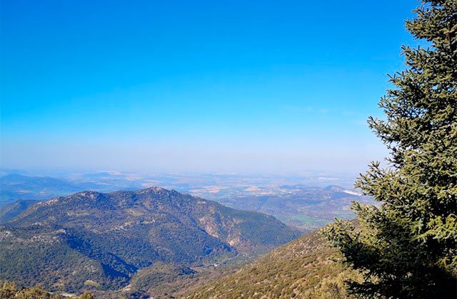
The trail is signposted and takes us to the summit of the province of Cadiz, a formidable landmark that offers views over a large part of western Andalusia. From here, we can take in: La Garganta Verde and part of the province of Seville (Sierra de El Terril) to the north; part of the province of Málaga (Sierra de las Nieves, Ronda, etc.) and Granada (Sierra Nevada) to the east; a large part of Cadiz, such as the neighbouring Los Alcornocales Natural Park to the south; and the bay of Cadiz (Gibraltar and the Strait) to the west. Weather permitting, the north of Africa and the city of Seville can even be spotted.
Having crossed the gate, head along the ancient Roman road that linked Arcos and Ronda, crossing the mountain range. Our climb starts here. Unfortunately, the trail has not been well maintained and stones have been laid as steps to make the _rst part of the trail easier. Don’t forget to stop and turn around to take in the panoramic views.
Gradually, we are able to spot Puerto del Boyar, El Reloj and El Simancón, La Silla, Prado del Rey, Arcos de la Frontera and the Bornos, Guadalcacín and los Hurones reservoirs, with Zahara reservoir visible from the top. When we reach the rocky area, proceed with caution; piles of stones serve as a signpost and mark the route, with some paint marks guiding us to the summit. Finally, our efforts are rewarded as we reach the top of El Torreón. Carefully head to the northern end and enjoy the wonderful bird’s eye view of Pinsapar.
Note: Before setting off, you must obtain a park permit in El Bosque: Tel. Tel.: 956 709733 or email: [email protected] (All trails for which a permit is required are closed between June and October due to the risk of fire) Pets are not allowed on this trail!
A stepped path departs the centre of Grazalema, close to km 48 on the A-372, which represents the start of the trail.
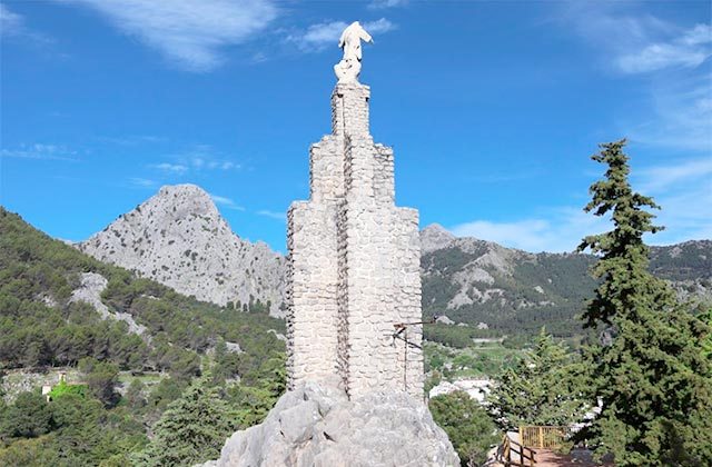
This route gently climes up amongst the pine trees to the fork between two different routes. One leads to the Calvario hermitage and the second to the Imagen del Sagrado Corazón de Jesús or el Santo, located on a magni_cent natural viewpoint.
This spot offers incredible views of the town of Grazalema. To the north is the Fresnillo dam, which supplies nearby towns and the port of las Palomas; to the west is Peñón Grande and the peak of San Cristobal; to the south is the Sierra Endrinal; and to the east is the Guadalete valley, the Gastor and Malaver peaks and the Mesa de Ronda la Vieja.
The trail starts at Puente de la Asamblea, located in the centre of Grazalema, next to Calle del Prado.
The path connects the centre of Grazalema directly to the Fresnillo reservoir. The trail starts on a gentle slope, on which hikers will come across a wide variety of plants and can catch a glimpse of griffon vultures and even wild goats on the crags. The route o_ers wonderful views of Sierra de las Nieves; a dense pine forest grows to the right of the path with titmice and chickadees taking refuge in its branches. The walk ends at the dam of the Fresnillo reservoir.
This small reservoir was built due to the lack of drinking water su_ered by residents in summer, despite being one of the areas on the mainland with the highest rainfalls.
From the hotel, head up towards Venta Los Alamillos at the crossroads, take the lane to the left of the restaurant.
This route is perfect for those looking for a comfortable trek accompanied by children. At the start of this stretch there are small houses and agricultural land, in addition to a range of plantations.
As we move on, we come across umbrella pines and a few cork oaks; this is a good area to spot birds such as the bee-eater, jay and a number of other birds of prey. After a moderate climb, we descend towards Llano de Campobuche, crossing the River Campobuche or Gaduares. The trail ends in the Campobuche flatlands, the perfect place to have a picnic or observe the surrounding wildlife.
From Calle Ronda in the centre of Grazalema.
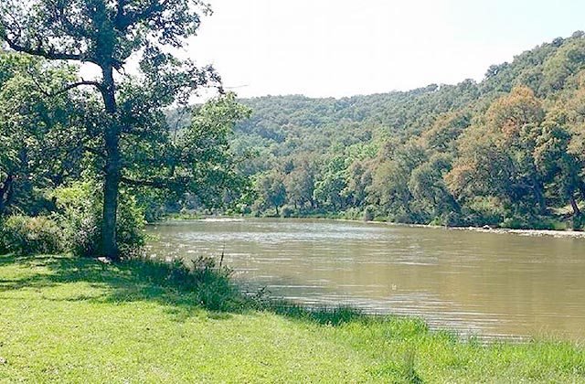
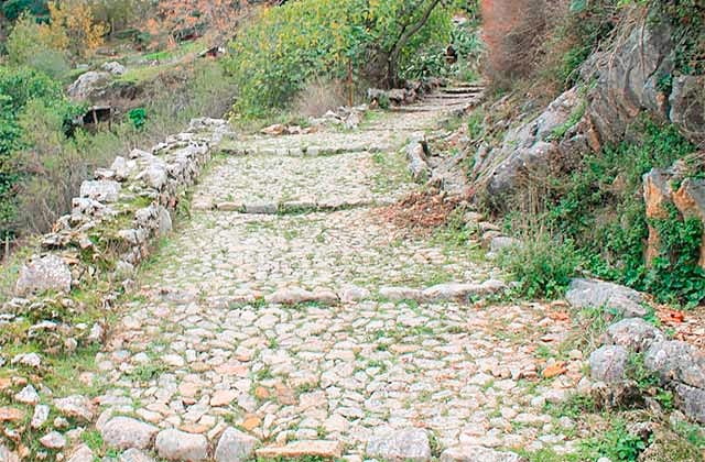
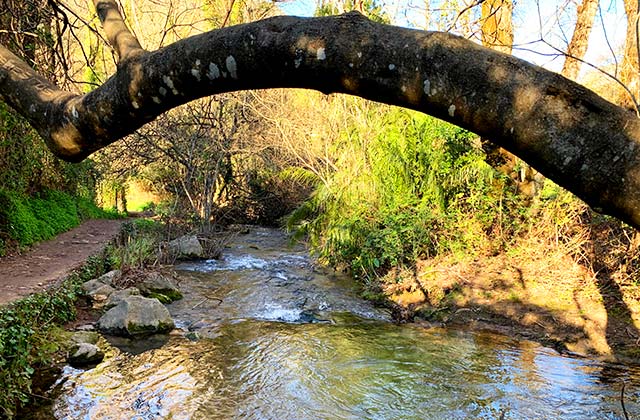
This route traces the lower part of Grazalema, around the River Guadalete, and follows an ancient, restored Medieval road, made using locally quarried limestone. The Medieval road of Grazalema is an extension of the two thousand year old route that crosses Manga de Villaluenga. Its path is de_ned by the rocky formation close to which it is located, with steep, narrow slopes.
Over the course of the route, hikers can enjoy the wealth of nature o_ered by the forest along the banks of the River Guadalete, formed by willows, ashes, oaks and alders, amongst others. This valley is known as Las Veguetas.
Drive along the A-372 to the Camping Tajo Rodillo car park. The trail starts on the stone steps close to km 48 to the west of Grazalema.
The uphill stone steps amongst pine trees that lead to a crossroads represent the start of the trail. Head straight on until the hermitage, where an uphill path leads o_ to the left amongst pine trees. Yellow painted arrows indicate the direction that we must follow.
Head along the Cortados de Peñaloja, which offer wonderful views of the Guadalete valley and pass through another pine forest which leads to Puerto de Retocapas, from where wonderful views of the Reloj and Simancon peaks can be taken in. Turn to the right, cycle the ridge and head through another pine forest.
Cycle the ridge again until you reach a point where you can spot Grazalema; from here, head right towards Cueva de las dos Puertas. Head back to the fork and start the descent (the trail is marked by a number of milestones). Head into the pine forest and come out just a few metres above our starting point.
Drive along the A-372 to the Camping Tajo Rodillo car park. From here, the trail is signposted.
This uphill trail takes us to the heart of the Endrinal mountain range, allowing us to discover a wide range of interesting formations, created by the weathering of the limestone, typical to the Sierra Grazalema Natural Park; furthermore, the trail offers us access not only to a sample of plants typical to the area, but also to one of the most emblematic animals of this mountain range: the mountain goat.
From the highest points, hikers can enjoy stunning views of this mountain range’s most famous peaks, such as El Reloj, El Simancon or Peñon Grande.
LONGITUD – 1,5 Km.
DURACIÓN – 1:00 h.
DIFICULTAD – Low
From Ubrique take the road A-2302 direction Benaocaz. The start is 1 km on the right.
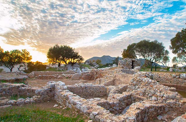
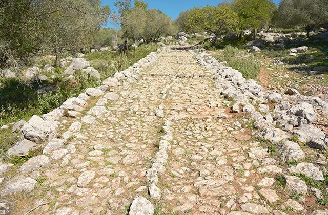
This trail runs along the Roman city of Ocuri located on top of the “Salto de la Mora” from where it dominates and controls the natural step towards Benaocaz and the passage of Villaluenga. It is the first Roman civilization discovered in Spain, and his remains suggest it was a very important city.
The starting point is at the visitor center Ocuri and the route runs at a conditioned b paved road with wooden fence.
From the ancient walled city, in the top you can see the south wonderful views of Ubrique”and in the north part you can see Benaocaz.
The first thing that appears is a mausoleum with some niches.Inside the walls you can see the trace of a city with remains walls of houses, old water pipes, public buildings, hot spring and forum.
Schedules guided tours are:
LENGTH – 9 Km.
DURATION – 3-4 h.
DIFFICULTY – Moderate
Drive along the A-372 to the Camping Tajo Rodillo car park close to km 47 to the west of Grazalema.
Our starting point is Camping Tajo Rodillo. Take the trail that leads o_ to the right, just after the camp-site. Head upwards, taking in the walled surfaces of Peñón Grande to the right.
Pass Era de Trillo, where wheat, oat and chickpea grain was separated from the cha_ until the mid-20th century; these cereals were sewn in any part of the ground that could be worked, no matter how small.
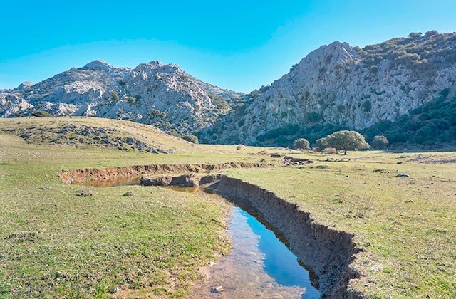
Head on to Llanos del Endrinal, where cereals were previously cultivated but that now serves as a home to pine trees, holm oaks and some bush species. Cross this flatland and head to Pozo Pilar Abrevadero, that covers the water needs of the sheep and cattle that graze on this mount. Gradually continue upwards to Puerto de las Presillas. Pass by the ancient Pozos de Nieve (the ice that accumulated here was used for large-scale hunts in the area to preserve the meat during transport to Coto Doñana, overnight so that the ice did not melt) and by Pozo Pilar de las Presillas, with its five pillars carved by hand using a hammer and chisel on the limestone rock.
Arriving at a crossroads, take the trail on the right-hand side, which leads to Puerto del Boyar. Before, take a quick look along the trail on the left-hand side, around 500 m after the gate, and enjoy the views over Valle de Las Encinas Gemelas (named as such by the El Tercer Tiempo task force). On our way down, cross the source of the River Guadalete and Calera del Navazo.
The Boyar viewpoint offers a 360o view of the stunning mountain range and the emblematic Salto del Cabrero. Head back towards the town on a pleasant marked trail along the River Guadalete until we reach our initial starting point, Camping Tajo Rodillo, once again.
LENGTH – 4 Km.
DURACIÓN – 2:00 h.
DIFFICULTY – Low
From Grazalema, take the A-372 towards Benamahoma. After 1.5 km, turn right and take the CA- 9104 towards Zahara de la Sierra. After 3 km uphill, we reach Puerto de las Palomas (1,357 m). The trail departs from the left-hand side of the car park in the pass.
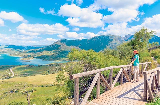
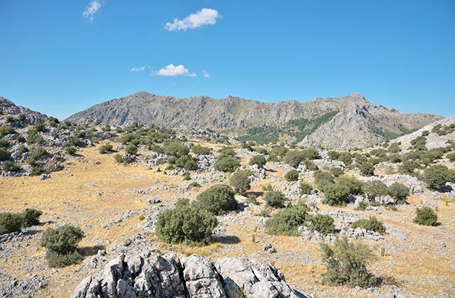
Our route starts to the left-hand side of the car park in Puerto de las Palomas. This path heads uphill bordering Sierra de Monte Prieto, offering spectacular views to the north over the Zahara-El Gastor reservoir and the towns of Zahara, Algodonales, Olvera and the countryside of Seville. As we cross the mountain, home to young holm oaks and native bush species, passing Cerro de los Coros, the Ribera de Gaidovar valley becomes visible with views of Sierra de Libar and Serranía de Ronda to the east, before climbing up to the peak of Cerro de los Coros. Griffon vultures and mountain goats can often be seen here and from the peak of the mountain, hikers can take the path that leads back to Puerto de las Palomas.
LENGTH – 10 Km. (Round trip)
DURATION – 2:30 h.
DIFFICULTY – Low
This route starts in the north east of Benamahoma, the lower part of the town, close to Venta el Bujío.
This route is one of the most popular in Sierra de Grazalema. Its ease and the beautiful landscape it takes in make it perfect for a family stroll.
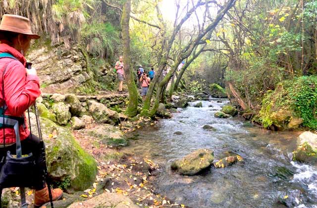
The route borders the River Majaceite and links the centre of Benamahoma with the centre of El Bosque.
This river is home to a wonderful gallery forest, a refreshing and beautiful natural tunnel. The poplars, willows, oleanders, prickly-ivys, rose bushes, brambles, clematis and honeysuckle, amongst others, grow so close together that it is impossible to penetrate the banks of the river, providing safe refuge to the abundant wildlife that resides within, such as otters and trout.
During the route, it is also possible to hear and spot a wide variety of birds, mainly the golden oriole, blackbird, wagtail, warbler, robin and nightingale.
LENGTH – 3,9 Km.
DURATION – 2:00 h.
DIFFICULTY – Low
From the town of Villaluenga del Rosario, just after you leave Grazalema, to the right close to the municipal swimming pool. Follow this small ravine, which lines the path to the flatlands.
The route starts close to the Villaluenga del Rosario hermitage, crossing an area of holm oaks and ends in the Llanos del Republicano, a long, narrow hollow, where the sense of isolation and peace is palpable.
The end of the trail is marked by Sima del Republicano, considered amongst the speleological attractions in the area.
Given the presence of cattle, don’t forget to close the gates as you head along the trail.
LENGTH – 3,4 Km.
DURATION – 2:00 h.
DIFFICULTY – Low
The trail starts on the A-2302 in Benaocaz, specifically at the town’s bus stop. If starting in Ubrique, look for the Capuchin monastery.
The route starts o_ downhill and crosses a bridge over a dry stream, where a signpost explains the technique used to build the Roman roads that gave their name to this route.
On top of the road, aromatic plants such as pennyroyal can be found, which live side-by-side with others such as palmetto or oleanders. Throughout the area, bird species such as warblers, goldfinches and finches thrive and can be spotted.
Continue along the road until you reach “Piedra del Toro” or “Cabeza del Toro”, known as such as a bull’s head has been painted onto it; legend has it that here, a battle was fought with stones between the residents of Benaocaz and Ubrique for the sculpture of San Blas, which the residents of the latter intended on stealing to seal its marriage to Virgen de los Remedios, the town’s patron.
The Roman road becomes a lane, which marks the end of the route.
LENGTH – 11,93 Km.
DURATION – 5:50 h.
DIFFICULTY – Moderate – High
Our starting point is Camping Tajo Rodillo at km 47 beside the town of Grazalema. The camp-site features a car park.
The _rst half hour is uphill on a well signposted route. Shortly after we start, we come across a gated fence. Later, we come across the remainder of an old threshing floor with an nformation board. Passing through pine forests in the shadow of Peñón Grande, we reach Llanos del Endrinal.
Keep heading uphill, now on limestone, seeking out the levellest ground to reach the peak of El Simancón.
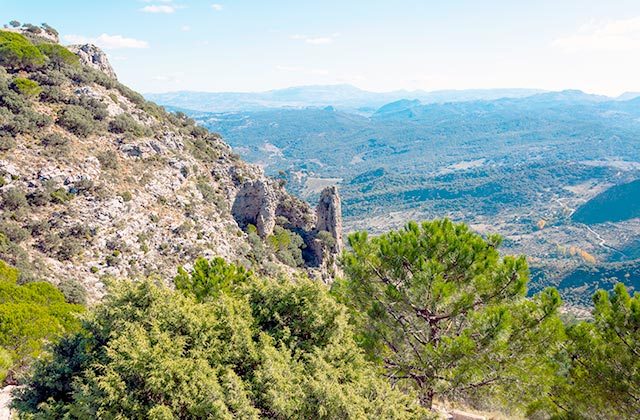
The path is well signposted. On the stretch of limestone, it is easy to follow the milestones and arrows painted along the way. From here, enjoy the spectacular views of the nearby Sierra del Pinar, topped by El Torreón, which is the park’s summit, and the province of Cadiz.
The peak of El Reloj looks close, but the descent from El Simancón and the climb of El Reloj is highly technical and hikers must proceed with care, especially if the ground is wet or snow has fallen. The descent from El Reloj is the most complex part of the trail. It is very steep and features loose rocks.
Almost the entire route back is relatively easy or downhill along a pleasant path. The last part of the trail coincides with the start.
LENGTH – 1,8 Km.
DURATION – 45 min.
DIFFICULTY – Low
HOW TO GET:
From Grazalema towards Benamahoma along the A-372, around 350 m away, a bridge crosses the River Guadalete. This represents the starting point for the hike.
This trail offers hikers a pleasant walk parallel to the source of the River Guadalete, which links the town of Grazalema to Puerto del Boyar. If heading off from the football pitch, after crossing a wooden bridge, there is a gradual climb to Puerto del Boyar, which offers spectacular views of Sierra de las Cumbres.
This route traces an ancient livestock trail used to transfer cattle from the mountains to the grassland beneath the town. Nowadays, residents in Grazalema often retrace their steps. The route is located in a zone of large reforested trees, which will provide welcome shelter in years to come.
Several stone tables offer rest stops along the way, from which hikers can enjoy views of the old limestone quarry before reaching Puerto del Boyar.
LENGTH – 1,2 Km.
DURATION – 35 min.
DIFFICULTY – Low
This trail begins just opposite the upper entrance to Benamahoma, on the A-372, close to the bus stop.
This route can be taken in either direction, whether from Benamahoma or from the Llanos del Campo recreation area. The trail runs alongside a canal that channels water from Arroyo del Descansadero to the orchards in Benamahoma, in addition to a small stone wall, which borders a property to the right.
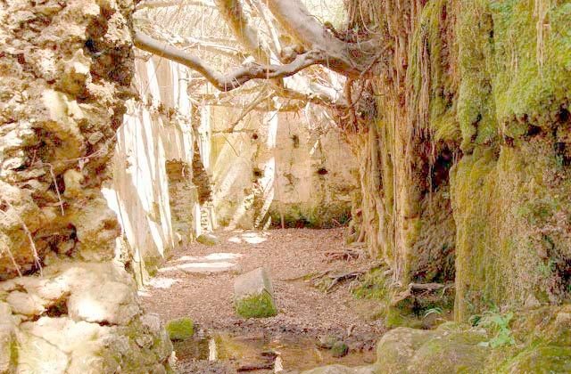
After passing the wall, we come to a small creek, which we must cross to reach the ruins of an old windmill (Molino del Susto).
Guided by the signposts, take care when crossing the road to resume on the gradual uphill path, driven by the babbling Arroyo del Descansadero.
The reeds and oleanders guide us to a small spring at the halfway point of the route, known as Fuente del Descansadero. Head up the steps amongst the white poplars that line both sides of the road. From here, pass through a couple of gates back to the recreation area.
LENGTH – 3,4 Km.
DURATION – 1:15 h.
DIFFICULTY – Low
From the hotel, take the road towards Grazalema and one kilometre before you reach the town, take the CA-9123 towards Algodonales. The trail starts on the left-hand side, 400 m after this crossroads.
This route takes in the zone that is home to Grazalema’s croplands, crossing the Ribera de Gaidovar and ending in the Pileta flatlands.
This valley has traditionally served as fertile croplands thanks to the abundance of water; the almond tree population here is worth particular note, dotting the landscape with colour when they bloom in winter.
The trail starts by crossing the road a number of times until we reach a spring with large weeping willows. From here, take the road to the left up to km 2, where hikers must take a path to the right to delve deeper into the riverbank before ending on the CA-9123, where the trail starts.
25 things you cannot miss from Grazalema and Ronda
Travelling with kids: good ideas for a family holiday in Sierra de Grazalema
Ronda and Grazalema sierra wineries
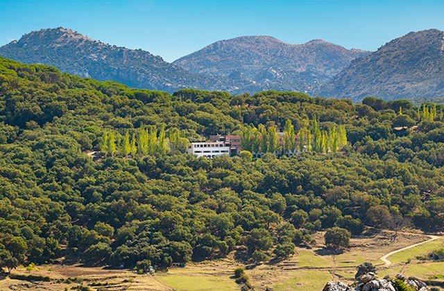
Hotel Fuerte Grazalema
If you come to Grazalema, there is no better place to stay than Fuerte Grazalema hotel. The hotel has 77 rooms with private balconies including spectacular views of the Guadalete Valley. Among the most loved services are the outdoor pool and the hot tub overlooking the Sierra de Grazalema. The hotel chain has branches where you can enjoy the best of each area throughout Andalucia, in addition to its services. Its more than 60 years of experience are the best guarantee.