The 23 festivals you can’t miss in Andalucia
Andalucia has the privilege of having an exceptional climate all year round, making it an attraction in all seasons. The possibilities of this region are not limited to sun and beach tourism in summer but also extend to fall and spring, with its pleasant temperatures, landscapes, and rural tourism.
But perhaps what you did not know is that there is snow in Andalucia and that is why winter is another of the seasons in which tourism is committed to come to southern Spain to make routes in the snow, hiking, or enjoy the most special winter scenery.
The mountains are covered with a white mantle and the panoramic views are so impressive that some seek to immortalize these peaks and breathe the purest air in the snowy areas of Andalucia.
Here are the most beautiful and spectacular places to enjoy snow routes in Andalucia.
El Cortijo Huarte is the starting point of our route, just above the recreational area of Los Sauces, near Yunquera, where we can leave the car and start the 17 km-long medium-difficulty trek. We will start by entering in the Spanish fir grove at Cubero, a forest of evergreens from the Cenozoic Era which marks the passing of time. The snow makes this a unique place.
Another attraction that this route offers is the ascent to the Puerto del Hornillo since, as we move on, we find caves where water, frozen by the low temperatures, forms ice floes at the entrance. This is an ideal place to rest before continuing pm to the last stretch towards the Puerto de las Camaretas and then begin the descent to the starting point.
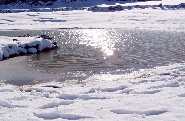
We start from Los Abades Service Area on the road from Loja, where we can leave the car or take it to the crossroads where we find the lake Charco del Negro, which originated from a glacier, the borders frozen by the cold and the snow. If we approach, we can look more closely at the Iberian ribbed newt which can reach up to 30 cm in length and which lives in the lagoon. This is a nice area to walk around with your family or continue on with the route.
We continue moving upwards, leaving aside the wind turbines until we reach Pico Cabras, at a height of 1642 m. From there we find a path that leads directly to an open space in which the formation of karst and sinkholes, typical rock formations in Sierra Gorda, are explained to us. A few metres down is the path which will lead us back to our starting point after about 12km.
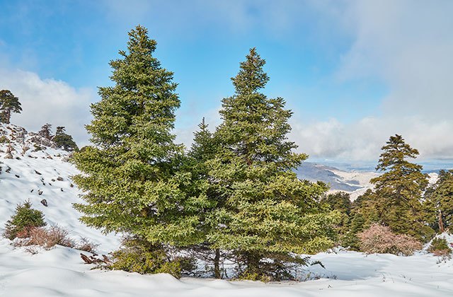
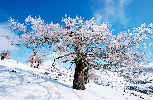
This trail is the most representative of the Sierra de Grazalema Natural Park as we will be walking through the best preserved Spanish fir forest in the world, covering the entire north side of the Sierra del Pinar.
We start this path in an old quarry next to the road between Grazalema and Zahara de la Sierra, 1 km after passing the Puerto del Boyar. We follow the path up the side of the Pico San Cristobal to reach the Puerto de las Cumbres. The road becomes a narrow path that goes into a thick Spanish fir tree grove with snowy trees over 30 meters high that share the area with the odd maple.
The way back is through meadows and oak trees which will accompany us along the descent. A total of 12 km along a path of moderate difficulty which will not fail to move any nature lover.
It is important to note that this part of the Sierra de Grazalema is a protected area and before you visit, you must ask permission in the Forest Visitor Centre by calling 956 709 733. Access with pets is also not allowed.
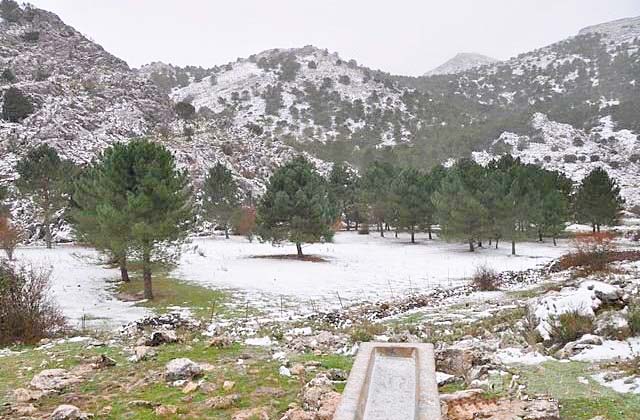
We started the route from the Tajo Rodillo campsite in the area of Grazalema, and go up the Cañada de Mahon to the port of Endrinal, where you see the Pico Simancón, forming a mountain chain with the Pico del Reloj. The 7 km-long circular path can be walked in about 3 hours, but instead we can simply descend to the Llano del Endrinal and enjoy the snow with kids for the whole day.
If we want to complete the route, we need to climb up to the Puerto de las Presillas where we need to take care with the Pozo de Nieves, one of the best-preserved artificial snowfields which were formerly used to store and preserve the ice. From this point, we join the path down from the Puerto del Boyar.
On the way down, we pass the source of the Guadalete River, which joins us in our journey back down the path of Charcones.
This is an 11 km-long circular of medium difficulty through the Sierra del Endrinal, located in Grazalema, with an ascent to Pico Simancón. We leave the car in the car park opposite the Tajo Roller campsite in the village of Grazalema, walking south on a trail that leads up to the Llanos del Endrinal. As you go up the Cerro del Simancón, the forest disappears to reveal the limestone.
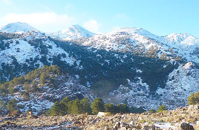
From the top, the entire Serranía de Ronda can be seen with the Sierra Nevada in the background, and on clear days, you can even see across to Morocco.
Going down, we enter a dense oak forest which we leave behind as we return to the Llanos del Endrinal.
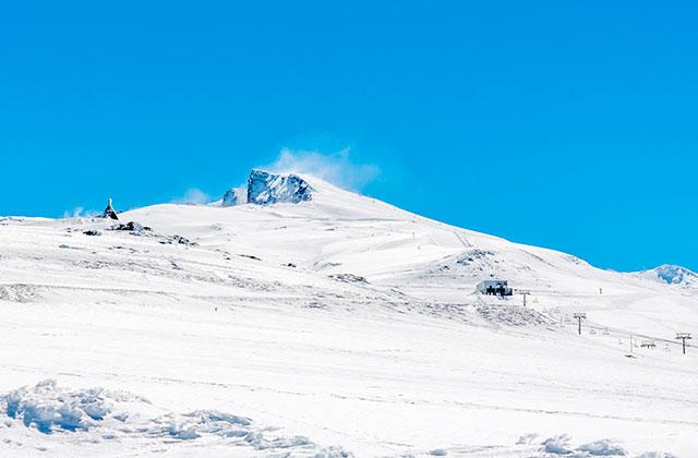
We will leave from the university hostel located in the Peñones de San Francisco. This area is known as la Hoya de la Mora, a good choice to spend the day with the kids where you can rent sleds and spend a day on the snow with them.
But if we want to reach the top of el Veleta, we take the road to the altar of the Virgen de las Nieves to start climbing and complete this medium difficulty route, with a length of 14.6 km.
We highly recommend the use of crampons to ensure you don’t fall and have a safe ascent where we can choose to follow the road or climb directly up one of the sides for a shorter but more intense way to reach the summit. The views are unique and unrepeatable, and much of the province of Jaén, the sierras and the coasts of Almería, the provinces of Córdoba and Málaga and even the Rock of Gibraltar and the Rif Mountains in the North Africa can be seen.
If we want to enjoy the diversity of colours and landscapes the Sierra de las Nieves can offer in only a couple of hours, this is our route. A circular 4.2 km-long path which allows us to enjoy with the whole family the contrast between the white natural limestone mountains and igneous ochres which can be glimpsed below the snow.
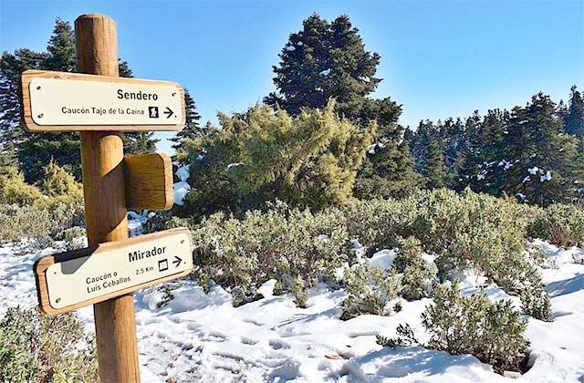
To do this, we leave from the Luis Ceballos viewpoint, where the trail begins and which leads us directly to a spectacular fir forest which we cross through, looking for the natural balcony inside. From there, we can see the village of Yunkera, the Hoya de Málaga, the coast and the sea.
We continue climbing up to the Tajo de la Caina, an impressive rock formation with a 100-metre vertical drop, and return to the starting point through a sunny area reaching the starting point.
3 hours and 15 minutes is what it will take us to walk this path with a medium-high difficulty near the town of Yunkera, where we will enjoy the high mountain gall-oak groves, meaning we are shaded for much of the route.
We start the trail from the Luis Ceballos viewpoint, choosing the southern mountain area and crossing Aleppo pine and oaks areas until and we arrive and pass through the Spanish firs.
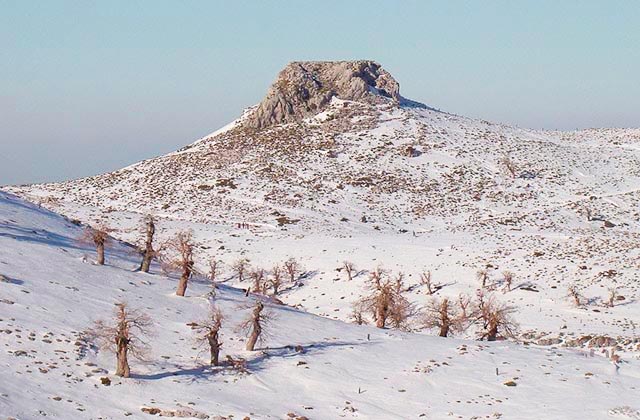
We continue climbing up to the Puerto de las Boas, a narrow passageway formed in limestone, and reach el Peñón de los Enamorados at an altitude of 880m, absolutely beautiful when it is snowy.
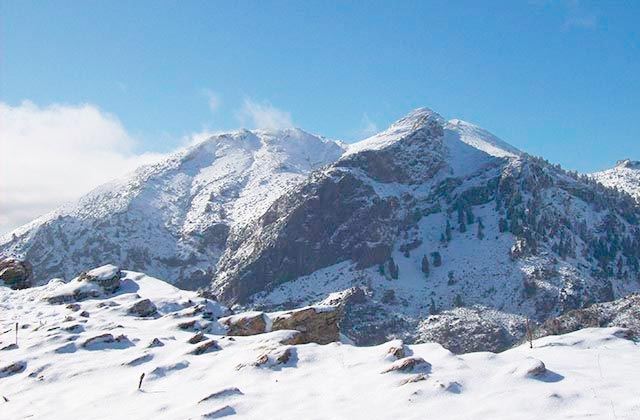
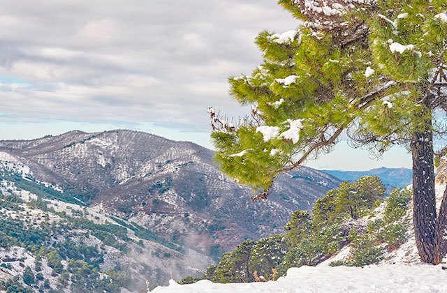
The Puerto de Saucillo viewpoint is our starting point on a route measuring 9.4 km which we only recommend for experienced walkers. However, it is essential if we want to see much of the province of Málaga framed between the Grande and Guadalhorce rivers. Immediately afterwards, we enter the Spanish fir forest which will join us along much of the route until, due to the altitude, we will only find bushes which are adapted to the altitude. We reach the port of Cuco and continue until the Tolox plateau where there are oak trees several centuries old and a pillar where we can cool off and get ready for the last part of the journey: the ascent to the Torrecilla. At 1919 metres, it is the highest peak in the Sierra de las Nieves and from its summit, we can see Sierra Nevada, the Mediterranean and the rest of the mountain range where we are.
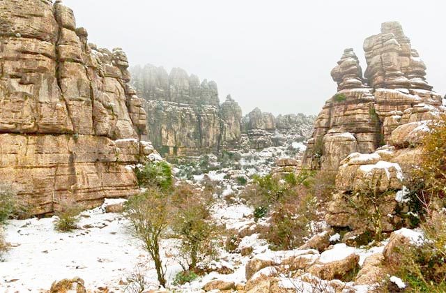
El Torcal de Antequera covers a landscape of spectacular shapes, perfect to visit at any time of year but when snow covers the rocks, it is a unique spectacle.
We choose to take the yellow route, perfect for the whole family. We leave from the Visitor Centre and follow the signs to guide us through the characteristic formations of the park such as the Tornillo (Screw), the Champiñón (Mushroom) or the Cornisa del Diablo (Devil’s Ledge).
Along the path, we will also enjoy the contrast between the ammonite fossils (molluscs which became extinct 65.5 million years ago) and the animals that live there now, like mountain goats and vultures.
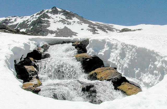
Los Lavaderos de la Reina is a wonderful high mountain hiking trail through the Sierra Nevada National Park. This trail shows us the great natural wealth enjoyed by this area of Andalucia. Here, if you come at the right time and thanks to the spring of the River Maitena, one of the big tributaries of the Genil, you will be able to enjoy through water, the source of life, the thaw process and the formation of waterfalls and snow tunnels. In conclusion then, this trail allows you to see how life makes its way through the ice.
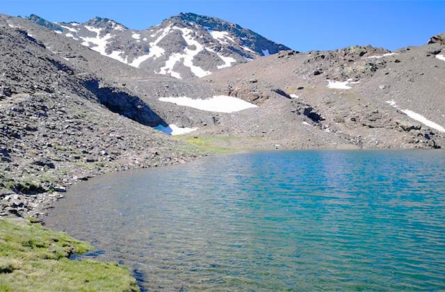
The Sierra Nevada is full of lagoons due to its different springs. This provides it with enormous value when it comes to biodiversity and an extremely important landscape heritage. It is one of the most important attractions in the Sierra. In the southern part, of the 42 fixed lagoons that exist, practically half of them are located in the course of the River Trevélez. Most of them are of glacier origin.
So imagine doing a hiking trail where we pass above an altitude of 10,500 ft, very near the impressive Veleta and enjoying the wealth of the Sierra Nevada through water, the source of life.
The best hiking trail you can do in El Chorro is undoubtedly the ascent to Pico Huma, or also called “The Balcony of Andalucia”, since from its summit that you can see practically the whole of Andalucia. On this 8.3 mile hiking trail, we can enjoy some amazing views. From above it all we can delight in a spectacular panoramic view made up of El Pico de la Capilla, El Torcal, El Camorro Alto, Peña Negra, La Sierra de las Cabras and the rest of El Arco Calizo.
The Sierra de Segura, in Jaén, is an undiscovered paradise that is covered in white in winter and offers panoramic views worthy of being immortalized while we make a path through the snow that this Sierra gives us.
The route of the source of the Segura River begins at this source, near the municipality of Pontones, and ends at the Mirador de León
It is a route of medium difficulty and that even the youngest can do, so it is an excellent winter plan to do with the family. All along the way you will enjoy the amazing nature. Towering pine forests, huge peaks, and meadows offer panoramic views, where you might even see a vulture flying overhead or a mouflon.
During the 5.6 km linear route of the source of the river Segura, you can tread on the immaculate snow left by the abundant winter snowfalls and perhaps receive some surprises. Like seeing the Guadalquivir Valley, an abandoned village and even the company of a little fawn.
This white paradise at this time of the year is a luxury for nature lovers.
It is one of the most famous mountain ranges in Andalucia and one of the most attractive for tourists in the region due to the nature and native fauna of this place.
Winter is the perfect time to visit and take one of the many routes it offers and enjoy the most Christmassy and wintry scenes.
Pico Cabañas is one of the most famous routes and one of the most impressive due to the white coat that covers it.
It has an elevation of 2028 meters and is of medium difficulty. The route starts at kilometer 23 from a parking lot on the way to the source of the Guadalquivir River.
This peak is one of the highest in the area and it is a luxury to enjoy the ancient yew trees and vegetation with the snow covering them. Along the way, weather permitting, you can see the Sierra Nevada and Cazorla Park itself.
In addition, bearded vultures or eagles roam these peaks, so you will be in full contact with the most characteristic flora and fauna of Cazorla.
The Sierra de Granada is the attraction of hiking lovers for the countless routes that can be found throughout the Natural Park of Baza.
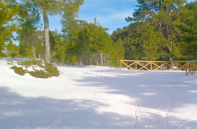
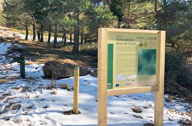
For those who are looking for a more wintry route and enjoy the white landscapes, Prados del Rey is a circular route of about 6 kilometers. It is the highest peak and along the route you will see the landscape of abandoned mines, the Calar de Santa Barbara and the town of Baza itself from the heights.
The route runs through wild pines, covered with white snow in winter, and is a real wonder in this forest full of native species such as oaks or maples. The richness of this mountain range is incomparable, with valleys and mines, and you can see golden eagles, foxes or wild cats, as they are species that inhabit this place.
The difficulty of this route is not high and you can leave your car under the pine trees where the road is in perfect condition until Narváez.
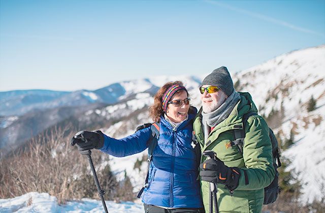
Observing nature, exercising and having fun with the family are the objectives when we go on a snow route with the family. However, it is recommended that you read these tips to prepare and consider what not to forget to make this experience a success.

The top 8 peaks in Andalucia: hiking on the highest peaks in southern Europe
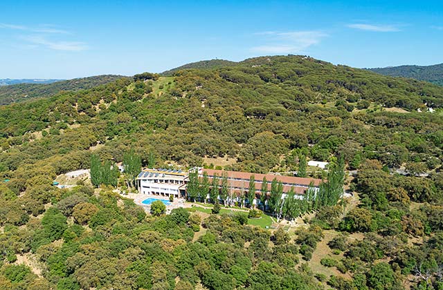
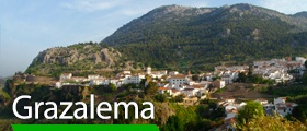
Hotel Fuerte Grazalema
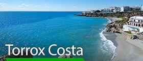
If you are looking for a getaway to enjoy these snowy enclaves, be sure to consult the Fuerte Hoteles offers. What better accommodation option in the middle of a natural park than hotel Fuerte Grazalema, next to the Serranía de Ronda. If you opt for the Sierra Nevada, the Olée Holiday Rentals apartments in Torrox are located less than one hour from the Sierra Nevada, allowing you to enjoy the snow and the beach on the same day, since this town has the best climate in Europe.