Enjoy a trip through the stars in these Andalucian enclaves of astrotourism
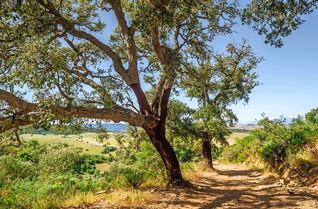
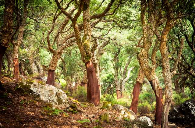
Alcalá de los Gazules, in Cadiz, offers you the chance to explore several hiking trails through the Natural Park los Alcornocales and its surrounding areas, which separates the coast (with Conil as the epicentre) from the mountain with Grazalema on the other side) . We have selected them for you and we would like to give you the details of each one of them. This village in Cádiz with typical white Andalusian houses is the perfect start to enjoy nature in a unique setting. This subtropical forest is the last remaining of its kind in Europe so put your trainers on and let’s go hiking around Andalusia.
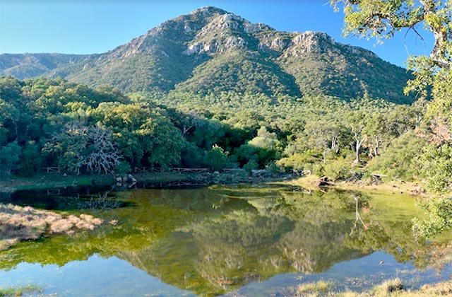
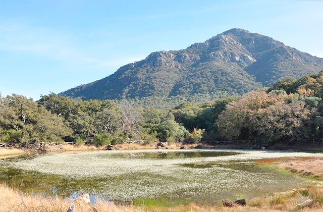
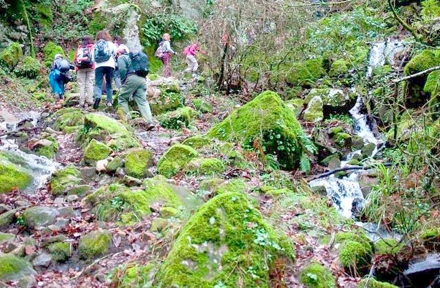
This tour is short and simple so it is suitable for all ages and requires no special permission to do it. It is also signposted with information panels. The starting point is in the recreation area of Picacho and it takes about an hour to do it. Enjoy the views with every step you take, especially the views of Picacho (silhouette of the mountains) and the lake with the same name. At first you’ll encounter the sloping terrain but that will end when you reach the lagoon. This place is surrounded by algae and a large number of frogs live here too, you will hear them croaking during the entire route.
The entire trail runs under cork oaks, although olive trees, asphodels and heathers are also abundant. Along the way you can see the remains of activities such as bakery, ranching and the production of coal. Finally, you will come across the ravine and the slot canyon of Puerto Oscuro, the stunning birth of Barbate river.
This route is six kilometres long and it takes approximately 3 to 4 hours to do it. The difficulty is medium-high and you have to be very attentive to the signs because the route coincides with other paths at various points and you have to take detours. To climb to Picacho you need a special permit that you can process at the Office of Natural park Los Alcornocales, in Alcalá de los Gazules during the morning.
The starting point is the same as Puerto Oscuro Gorge , Picacho’s recreational area. In the beginning we enter a cork oak forest with riparian vegetation to reach a paved forest trail. At this point we have to go straight while the road that leading to the reservoir is diverted to the right. The stone beacons will guide us along the way. The cork is still the protagonist in this stretch leaving beautiful images on our way.
We come to a rest area where we see the Picacho in the background. Here you can take some fresh air for a few minutes and continue the climb. For the next few meters a new species is waiting for us: the pine, which will be present until the end of the tour. During the trail we find the Puerto de las Calabazas, which gives us fantastic views of Alcalá de los Gazules and Puerto Oscuro lagoon. Our destination is getting closer.
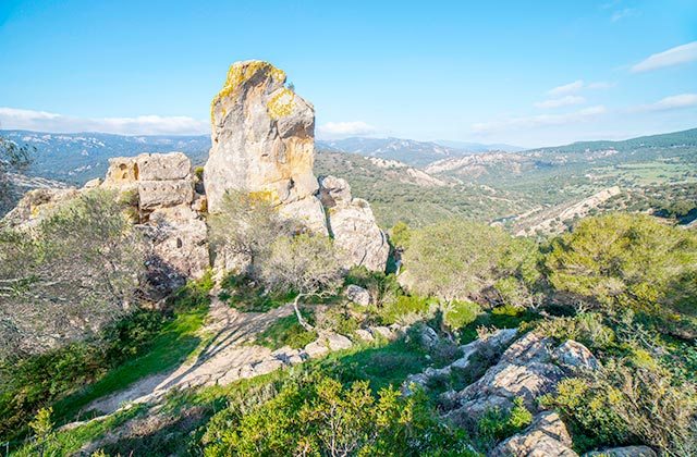
In the last section the slope is accentuated so we must make the last effort. Once up on Picacho we can admire other towns like Barbate, Vejer de la Frontera and Benalup. We will also observe Sierra de Grazalema at the distance. A rewarding moment that you can keep forever taking a beautiful picture with your camera.
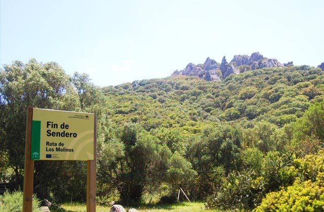
You do not have to ask for permission to access this route because is a free access trail. It is a medium difficulty route, 3.5 kilometres long that runs in a straight line. The estimated time to do it is one hour. The starting point is in Alcalá, at the end of Patrite CA-2115 road and finishes just before crossing Montero river.
It is important to note the importance that mills had in the local industry for centuries, so this path, in addition to having a significant importance as far as landscapes go, it is also important for its cultural significance. In this way, the trail follows the mills called “del Patrite”, a place characterised by the water that flows down Montero river towards Rocinejo river.
The names of these structures we encounter are: Perdido, Nuevo, Halcón, Cárdenas, El Acebuchal, El Nogal, El Olivar, Castro Arriba, Castro Abajo, Los Espartiores o Repartidores, El Canto, La Chiva, La Menacha, La Llave, San Jorge, San Francisco, El Prado and La Molineta these last few ones located up river, and although we do not walk very near them we can still see them.
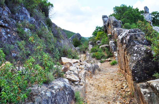
The beginning of the trail is fairly flat, with large rocks to the left and trees and the river on the right. The cao runs parallel to the river (a canal that fed the mills located downstream). Eucalyptus trees stand out from the rest.
We begin to climb a more open area, and we can see the mountains in the background reaching a moment of our tour where we will be located under a huge pine.
The road follows a narrow path between the mountain we surrounded and ends before crossing Montero river, in a small extension of land where the last mill of this trail is located, los Espartiores or Repartidores.
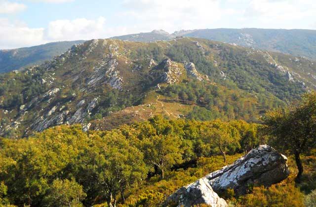
This route is ten kilometres long and it takes approximately 5 to 6 hours to do it. The difficulty is high so you have to be used to mountain hiking to do it. To climb you need a special permit that you can process at the Office of Natural park Los Alcornocales, in Alcalá de los Gazules during the morning.
The starting point is Picacho’s recreational area, so you have to be careful not to get confused with other routes that start at the same place. So the trail first runs as Subida al Picacho, in the first section it fully coincides with this route, but on reaching Puerto de las Calabazas we need to turn to the right, looking for the perimeter firewall or stone wall of the edge of the mount.
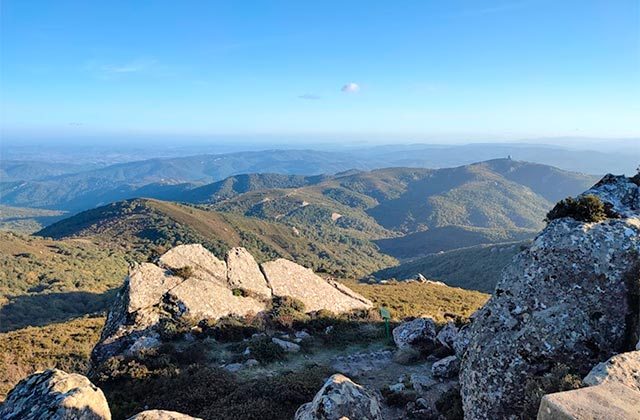
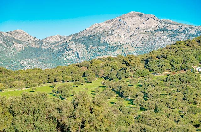
You can enjoy the vegetation full of hollies and oaks from other parts of the world. Following the path we come out on the forest track that leads directly to Pico del Aljibe, 1100 meters high.
At this point we are on the border between the provinces of Malaga and Cadiz, the part belonging to Malaga starts when we descend.
We must be alert and walk in parallel to the willows until we reach the bike path. We will continue this way until we find the Pasadallana Gorge where we will keep going down in parallel. Thus we come to the end of this tour in the recreational area of La Sauceda, where we find old water mills and uninhabited houses. If you do not want to return back on foot it is advisable to take two cars and leave one at the exit point and another at the arrival site.
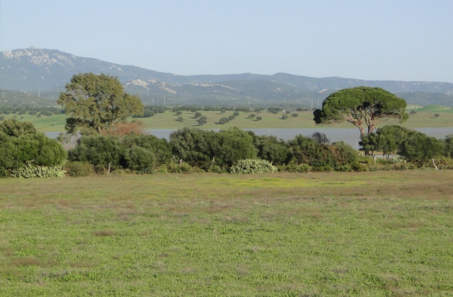
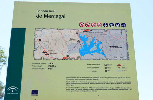
This path has a low difficulty even though we are talking about a 14 kilometres trail. We do not need permission to do this and the estimated duration time is 2 to 3 hours. It is a linear path that starts at the Visitors Centre El Aljibe, and leads to the banks of the swamp of Barbate.
This route passes through various different areas with cattle: the first one Cañada Real Los Ratones , which gives its name to the path, the second one called Cañada Real Jerezana or Marchantiega that leads to the bird observatory and the third one the Cañada Real de Mercegal, staying with us till the end.
The starting point is the Visitor Center El Aljibe and from the beginning we enter a vegetable world with olive trees, mastics and some huge fan palms. We follow the Cañada Real Marchantiega that will lead to an eucalyptus island with prickly pears and tamarisk, also the location of the bird observatory. Here you can see different aquatic birds to take pictures of.
We continue the path and we turn left along Cañada Real Mercegal, where you can see Alcalá de los Gazules at the distance. We enter an olive tree and cork forest that will take us to the banks of the swamp.
Here you will find part of the history of the region as there is a necropolis belonging to the Copper Age. The return is along the same path.
This route is thirteen kilometres long and it takes approximately 3 to 4 hours to do it. The climb presents medium difficulty and you need a special permit that you can process at the Office of Natural park Los Alcornocales, in Alcalá de los Gazules during the morning.
The starting point is again Picacho’s recreational area. The first stretch coincides with the path Subida al Picacho, and with Puerto Oscuro Gorge. Once going through this gorge’s wooden bridge, we turn to the right (as we did during the crossing) and that will lead us to the track. Everything is marked so that we do not get lost but we have to be alert so that we don’t get lost in other trails. Once there we follow the trail to the forest retreat located above. At this point we have to take a diversion to move towards the top of the mountain. We enter into a wetland and crowded with ferns, which as we ascend turns into a low scrub area following the directions that will lead to a paved path, the path here separates Subida al Picacho, since we have to follow the paved trail to the right until we reach a forest shelter located just above. Once at the shelter we take a diversion until we reach the summit. In wetter areas we observe ferns in large quantity which turn into scrublands with rockroses and robledillas. From the lane, in a stream bed, we can see some lonely holly. In a small detour to the left we can find a spring called “Gato” (Cat).
And on top you can see the Straits of Gibraltar and the nearby villages. The return is along the same path.
Remember that safety is paramount when hiking anywhere, and following these tips will help you have a memorable experience in the province of Cadiz while taking care of the natural environment.
The best hiking trails in Cadiz: options for this outdoor sport
Hiking path along the river Majaceite in Grazalema: ideal for children and pets
Put on your boots and explore the 20 best Grazalema hiking trails
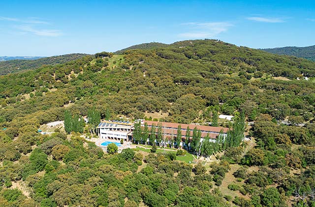
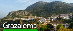
Hotel Fuerte Grazalema
Fuerte Hoteles is always the best option to stay in Andalusia, visit its cities and rest. The chain has hotels where you can enjoy the best of each area of the region, Fuerte Grazalema being a good example, nestled in the mountains and featuring a spectacular pool that makes you forget everything and enjoy your holidays in the most natural way. On the other hand, if you prefer relaxing on the beach, Fuerte Conil Resort is located opposite one of the most beautiful beaches in Spain, La Fontanilla beach. It stands out due to its unique Andalusian style, its 25,000 square meters of gardens, 4 outdoor pools, jacuzzi, tennis courts and a full service spa. Definitely the best option to enjoy your days of leisure between the tranquillity of the sea and the adrenalin the hiking trails of Alcalá de los Gazules offers.